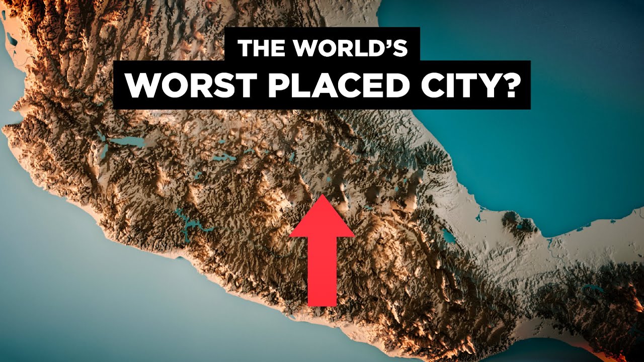
Understanding the Topographical Map of Mexico City
Mexico City, one of the largest urban centers in the world, is uniquely positioned in a valley surrounded by mountains and volcanoes. The topographical map of Mexico City reveals its diverse elevation and terrain, which significantly influence its climate, infrastructure, and urban development. At the heart of the map lies the Valley of Mexico, an ancient basin that has played a crucial role in the region’s history. The valley is flanked by towering volcanic peaks such as Popocatépetl and Iztaccíhuatl, which are not only iconic landmarks but also pivotal in shaping the city’s topography.
The elevation levels within Mexico City vary considerably, ranging from approximately 2,200 meters (7,200 feet) to 3,930 meters (12,890 feet) above sea level. This variation is crucial for understanding the city’s climate patterns, as areas at higher elevations tend to be cooler and receive more precipitation than those in the lower parts of the valley. The topographical map highlights these differences, providing valuable insights for urban planners and developers who must consider the challenges posed by such diverse terrain. Moreover, the map illustrates the city’s susceptibility to natural phenomena like flooding and earthquakes, due to its location on a former lakebed and proximity to seismic activity.
The topographical features also play a significant role in the cultural and economic aspects of Mexico City. The highlands and valleys depicted on the map have historically influenced settlement patterns, with ancient civilizations like the Aztecs strategically building their cities on islands and elevated areas to avoid flooding. Today, these features continue to impact urban sprawl, transportation networks, and real estate development. Understanding the topographical map allows for a deeper appreciation of how geography has shaped, and continues to shape, the vibrant and dynamic metropolis that is Mexico City.
Key Features of Mexico City’s Topography
Mexico City’s topography is characterized by its unique position within the Valley of Mexico, an expansive highland basin surrounded by towering mountains and volcanoes. Situated at an elevation of approximately 2,240 meters (7,350 feet) above sea level, this vast urban area is nestled between the Sierra de las Cruces to the west and the Sierra de Ajusco-Chichinauhtzin to the south. The city’s high altitude contributes to its distinctive climate and has a significant impact on its weather patterns, resulting in mild temperatures year-round. The basin’s natural bowl shape plays a crucial role in influencing air circulation and pollution levels, a factor that has become increasingly important as the city’s population continues to grow.
The Valley of Mexico itself is an ancient lakebed, remnants of which can still be found in the form of lakes and wetlands scattered throughout the region. Historically, these bodies of water were part of a larger network that included Lake Texcoco, Lake Xochimilco, and Lake Chalco. Although much of this water system has been drained or reduced due to urban development, these remnants continue to shape the landscape and contribute to the area’s biodiversity. The presence of these historical water bodies is evident in the Xochimilco canals, a UNESCO World Heritage Site, which offers a glimpse into the region’s pre-Hispanic past and its agricultural significance.
Volcanic activity has also played a pivotal role in shaping Mexico City’s topography. The iconic Popocatépetl and Iztaccíhuatl volcanoes are prominent features of the landscape, providing a dramatic backdrop to the city. These majestic peaks not only add to the aesthetic appeal of the region but also have a geological impact, influencing the soil composition and seismic activity in the area. The volcanic soil is particularly fertile, supporting a diverse range of plant species and contributing to the rich agricultural traditions of the surrounding areas.
In addition to its natural features, Mexico City’s topography is marked by a complex urban landscape that reflects its history of rapid expansion and development. The city is characterized by a mixture of flat areas and steep inclines, with neighborhoods built into the sides of hills and mountains. This varied terrain has led to a diverse urban environment where modern skyscrapers coexist with traditional architecture, creating a vibrant and dynamic cityscape. The interplay between natural and human-made elements in Mexico City’s topography makes it a fascinating subject for geographers, urban planners, and visitors alike.
Best Helicopter Tour in Mexico City
How to Access and Use a Topographical Map of Mexico City
To access a topographical map of Mexico City, you can start by visiting online geographical databases or government websites that specialize in cartography and geographic information systems (GIS). These platforms often provide digital topographical maps that can be downloaded or viewed online. Alternatively, you may find printed versions available at local libraries, bookstores, or specialized map retailers. When accessing these resources, ensure that the maps are up-to-date and from a reliable source to ensure accuracy and relevancy for your needs.
Once you have access to a topographical map of Mexico City, it’s essential to understand how to interpret the various symbols and lines. Topographical maps are detailed and use contour lines to represent elevation changes across the landscape. By examining these lines, you can determine the slope of the terrain and identify features such as hills, valleys, and plateaus. Pay attention to the map’s legend, which will explain the meaning of different symbols and colors used to depict various landforms and man-made structures within the city.
Using a topographical map effectively involves several key techniques. First, orient the map by aligning it with the cardinal directions, usually indicated by a north arrow on the map itself. Next, identify key landmarks and use them as reference points to understand your current location within the city. If you’re planning a hike or outdoor activity, analyze the contour lines to assess the difficulty of the terrain and plan your route accordingly. Finally, consider using a compass or GPS device in conjunction with the map to enhance navigation accuracy, especially in areas where landmarks may not be easily visible.
Understanding how to read and use a topographical map of Mexico City can greatly enhance your exploration and appreciation of the city’s diverse landscapes. Whether you’re a local resident, tourist, or outdoor enthusiast, mastering these skills will allow you to navigate the city with confidence and uncover hidden gems that might otherwise go unnoticed.
Benefits of Studying Mexico City’s Topographical Map
Understanding the topographical map of Mexico City offers numerous benefits, especially for urban planners and geographers. By analyzing the elevation, slope, and natural features of the landscape, planners can make informed decisions about infrastructure development, flood control, and sustainable urban growth. The map provides a detailed view of the city’s terrain, helping to identify areas prone to natural disasters like earthquakes and floods. This knowledge is crucial in implementing effective risk management strategies, ensuring the safety and resilience of urban environments.
For environmental scientists and ecologists, studying Mexico City’s topographical map is instrumental in understanding the region’s biodiversity and ecological patterns. The city’s varied elevations and landforms create unique habitats that support diverse plant and animal species. By examining these features, researchers can identify critical areas for conservation and assess the impacts of urbanization on local ecosystems. Additionally, topographical data can aid in tracking changes in land use and vegetation cover over time, providing valuable insights into environmental sustainability and the effects of climate change.
Outdoor enthusiasts and adventurers can also greatly benefit from exploring Mexico City’s topographical map. The detailed contours and elevations help hikers, bikers, and climbers plan their routes more effectively, ensuring a safe and enjoyable experience. The map highlights trails, peaks, and natural landmarks, allowing adventurers to discover new areas and appreciate the city’s stunning natural beauty. Whether for professional or recreational purposes, the map serves as an indispensable tool for navigating and exploring the diverse landscapes surrounding Mexico City.
Top Resources for Finding Accurate Topographical Maps of Mexico City
When it comes to obtaining precise topographical maps of Mexico City, there are several authoritative resources that stand out for their reliability and comprehensiveness. The National Institute of Statistics and Geography (INEGI) is a primary source for detailed cartographic information. INEGI offers a range of digital maps that provide insights into the varied topography of Mexico City, showcasing elevation, terrain types, and urban planning details. These maps are accessible through their online portal, where users can download high-resolution versions for professional or personal use.
Another invaluable resource is the U.S. Geological Survey (USGS), which offers topographical maps that include Mexico City as part of their international mapping services. While primarily focused on the United States, the USGS collaborates with global entities to provide comprehensive geographic data. Their maps are renowned for their precision and are particularly useful for researchers and professionals who require detailed elevation data and landscape features for environmental studies or urban development projects.
For those seeking more interactive and user-friendly options, Google Earth is an excellent tool for exploring Mexico City’s topography. With its 3D mapping capabilities, Google Earth allows users to visualize the city’s landscape dynamically. It offers an immersive experience, enabling users to navigate through different areas of the city while examining elevations and terrain features. This tool is particularly beneficial for educators and students, providing an engaging way to study the geographical intricacies of Mexico City.
Moreover, OpenStreetMap is a community-driven platform that provides free and editable maps of Mexico City. While it may not offer the same level of detail as official government resources, it is a valuable tool for those who require up-to-date information on the city’s ever-changing landscape. OpenStreetMap’s collaborative nature ensures that the maps are frequently updated, reflecting recent changes in the urban environment, which can be particularly useful for travelers and locals alike.


